A top quality ride

What makes a good quality bike ride? There are so many factors … the terrain, the scenery, the company, the bike, the distance, the weather, the desire to get out there and ride.

Today’s ride was relatively short, I was alone, the bike was my fixed wheel, the weather was OK, although in comparison with the last couple of weeks, today’s weather was fantastic. I’ve been off the bike for over a fortnight having spent a week in Wales where the weather was cold and the roads were icy, and a week in London where I didn’t have a bike :-( So I was most definitely up for a ride after such a long lay-off!

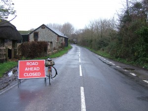
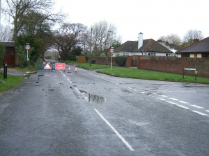
I left home at 10am under grey skies, and almost immediately things were looking up when I ran into a ‘Road Closed’ sign due to flooding. West Lane Hayling Island I took this as an invitation to enjoy some traffic-free riding. And so it proved, West Lane on Hayling Island can be something of a racetrack for vehicles aiming to get off the island quickly, so riding car(e) free was lovely. I knew the flooded part was at the Northern end of the lane so turned right along Daw Lane and crossed the main road into Yew Tree Road and Copse Lane, where I found another Road Closed sign – this ride was definitely looking very positive :-) Copse Lane Hayling Island In fact the road closed notice was completely spurious as there was nothing worse than some big puddles all the way to the bridge onto the mainland.
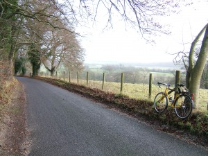
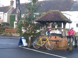
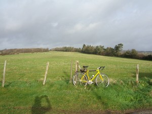
My route went through central Havant then North through Rowlands Castle, Finchdean and past the isolated church of St Huberts at Idsworth, before turning right through woodland and sheep farming country to Littlegreen school on the B2146 West Sussex Near Little Green where I turned right again to cycle into the rather lovely downland village of Compton where there is a great tea room, and as a bonus two friends, Alison and Geoff arrived at the same time as I did. Compton Tea Room We spent a pleasant half hour catching up on news and chatting over tea and cakes. Alison and Geoff set off to follow my incoming route and I headed further into Sussex on the quiet lane to Up Marden. As the name suggests this was the highest point on the ride at 151m, and the steepest climb too at 10% which is no problem on my lowish fixed gear of 42/17 or 66 inches. West Sussex Near Up Marden
The church of St Michael at Up Marden is a gem. Up Marden Church It is an unspoilt 13th century building invisible from the road; the approach is along a bridleway. The church has no electricity so candles are still used for illumination. This must be one of the most peaceful places in Southern England, and it’s easy to believe that little has changed here in hundreds of years. I usually stop here just to enjoy the calm, and the feeling of stepping into a timeless place. According to Ian Nairn and Sir Nicholas Pevsner, writing in ‘The Buildings of England’:
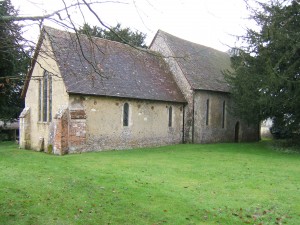
St Michael. One of the loveliest interiors in England. Atmosphere is perhaps something which ought not to have much to do with ‘The Buildings of England’ but at Up Marden the atmosphere is as tangible as any moulding, the slow, loving, gentle accretion century by century until it is something as organic as any of the South Downs views around it. It must not be seen in antiquarian terms, or even as an interesting speciment of an unrestored church but as visible loving testimony of the faith of successive generations. It is incredibly moving …
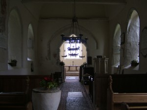
Up Marden Church Interior Although the church dates from the 13th century, it seems likely that the site was a place of religious worship in earlier times.

The bridleway to the church had left my wheel rims plastered with mud. On the ride downhill from Up Marden to Walderton I was able to keep the speed down with back pressure on the fixed wheel, avoiding grinding down the rims with the equally muddy brake blocks. Another flood across the road at Walderton washed the wheels a bit, but not at all clean – that mud is sticky stuff.

Heading towards home, my route took the narrow lane past the Racton Monument. Racton Monument Feeling in need of lunch now, I went the quick way along Emsworth Common Road, back through Havant and down onto Hayling Island where Northney Road / Copse Lane, Daw Lane Daw Lane Hayling Island and West Lane were still closed due to floods, but in fact, after 8 hours of drainage since the last rain, were easily passable by bike.
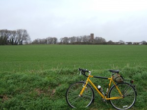
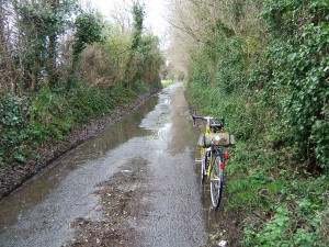
I’ve ridden fixed wheel bikes for (gulp!) over 50 years now (I was an early adopter), and still I have a love/hate relationship with fixed. Today I loved it. The feeling of control, especially at low speeds through the floods, is something unattainable on a freewheel. I got round the whole 55km ride without using my brakes once, back pressure on the pedals was enough for all my slowing and stopping, and given the filthy conditions today that is a great rim-saver. The 66″ gear got me up all the climbs relatively easily, and enabled me to go slow on the downhills. So what about the hate part? Steep downhills are the worst. For me discretion becomes the better part of valour at around 180 pedal revs per minute; on a 66″ gear that’s about 57 kph or 35 mph. It’s the speed when I worry about my knees exploding. However it isn’t the speed so much as the revs that demand 100% concentration (99.9% isn’t good enough) and the prospect of something going wrong at those speeds with a fixed cog and legs whizzing round is inhibiting, to put it mildly. Also I like freewheeling. It’s a joy to whizz down hills powered only by gravity, and all that concentration can be focused on picking the optimum lines through the bends (which are not the same as fixed wheel lines anyway). Unless riding with a number of other gear-deprived riders, the fixed wheel seems a bit anti-social; you tend to climb faster than those who reach for low gears, which might seem like showing off, and on the downside of the hills you aren’t always able to keep up when riding a low gear like mine. However today I rode at my own pace and it was a joy. It may have been only 55 km, but I saw little traffic, the views were fantastic, having tea with friends was great, the visit to Up Marden church was a treat, and the bike rolled silently and problem-free all the way. That’s a quality ride :-)

Dunwich Dynamo XX

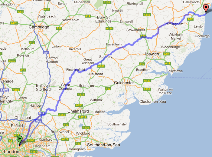
Saturday 30 June 2012, the date of the twentieth edition of the Dunwich Dynamo, a night ride from London to Dunwich, the lost city on the Suffolk coast. 1500 years ago Dunwich was the capital city of East Anglia but in 2001 the population of Dunwich was just 84; much of the town was swept away in a storm surge on 1 January 1286 and now little remains on the land. There is, however, a great beach, and a good pub :-)

Map of route

The Dun Run is proud of its rather anarchistic roots. There are no entry fees, if you want to do it just turn up at the Pub in the Park, London Fields and start whenever you feel like it during the evening.
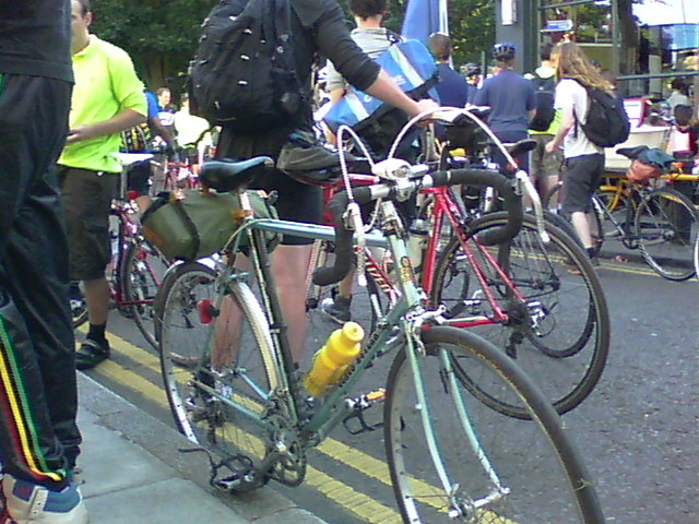
Ready for the off

The date was well chosen as 30 June was the night of the full moon and close to the longest day of the year. I rolled up at around 7pm and there were already well over a thousand cyclists there. In the crowd I met Wernher who I’ve ridden with before, and as he had completed the ride five times before it seemed a good idea for me, as a Dunwich Dynamo virgin, to accompany him. Magically some organisational fairies had printed a route sheet, so I dropped a pound in the bucket for a copy, and we departed at about 8:30 pm.

The ride through London out to Epping was amazing in the company of hundreds of cyclists stretching as far as you could see both ahead and behind. Progress amidst all the London traffic was pretty slow, though everybody seemed to be in good humour.

It started to get darker as we rode through Epping Forest, all the pubs along the way seemed to be packed with cyclists. And in darkest Essex people in remote villages were sitting out by the roadside and clapping and cheering the riders. My only nasty incident was hitting a pothole when freewheeling downhill near Dunmow. The force of the impact moved my handlebars round by some distance, which was probably a good thing as it must have absorbed some of the impact rather like a crumple zone in a car … better than folding my front wheel anyway. Earlier in the day I had inflated my tyres with 6 bar / 90 psi in front and 7 bar / 100 psi in the back tyre, so I didn’t get a pinch puncture either. It was a lucky escape and I was glad I was well balanced and freewheeling; it would have been much more tricky with my legs flailing around on a fixed wheel. Scary. I was riding close to the centre of the road, but never saw the pothole. (Note for future – must use better lights next time, <envy> some of the lights on this year’s run were astonishingly bright </envy>.) Some say that 36 spokes in a front wheel is too many, but on this occasion I was glad to have all the help and additional strength I could get and felt thankful I wasn’t riding a 20 spoke racing wheel with 44% fewer spokes. It was probably the same impact that shook my back mudguard out of the clip that secures it to the chainstay bridge that I had to fix when I noticed the problem later on. Otherwise though we had no mechanical incidents :-)

Some of the guys were enjoying themselves by flying along in a swoosh of tyres at racing speed; very impressive but I’m not really sure of the point of getting to the beach in the early hours. And they probably missed the novelty of bats flashing across your line of vision as they were briefly illuminated by the bike lights. Kudos on this ride seems to derive more from how unusual is the bike you ride, rather than how fast you ride it; hence previous rides have been completed on workbikes, a city of London ‘Boris bike’, folders, and even a penny farthing!

There was a rest stop at Sible Hedingham, just under half way, but whatever you wanted involved a substantial queue, so it was lucky Wernher and I had brought sufficient food to cut out the queueing. Again all the pubs around were full of cyclists, avoiding the queues by other means.

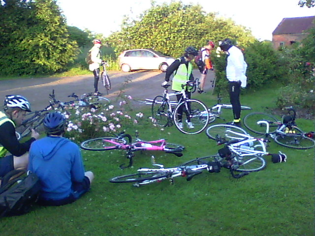
The second half of the ride was really nice. The organisational fairies had visited any tricky turnings that might be missed and left a tea light in a jam jar to make sure we had a good chance of seeing the turn. Mind you losing the route was difficult as there always seemed to be a string of flashing tail lights showing the way. In the middle of the night pit stop marquees appeared selling drinks and snacks; the Dynamo generates its own economy! Even the pubs were still open well after their normal closing time – just selling teas and coffees of course ;-) The last pit stop, near Framlingham, was lovely with good company, free tea or coffee and a good range of snacks in the warmth of the early morning sun.
Framlingham pit stop

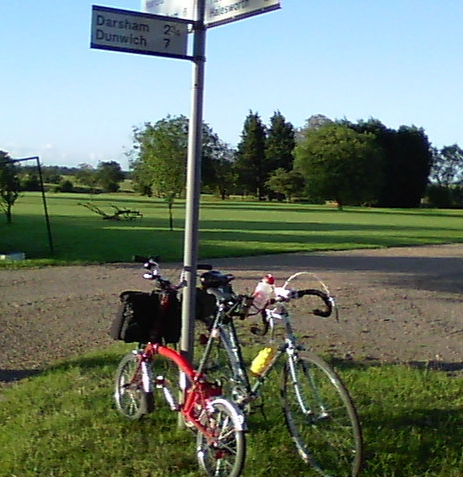
There were no real hills, just gentle undulations and I only used three gears during the whole ride, never using the small chainring. Riding with Wernher made my ride especially easy as he did the ride on his Brompton which was harder work than my circa 1980 Claud Butler 10 speed. I was floating away from him on any uphill bits then taking it easy while he caught up again, so for me it was a real no-strain ride. However the first signpost to Dunwich was a welcome sight. Signpost to Dunwich We rolled up on the beach at Dunwich at 6:30 am with 182 km from London on the computer.Flowers on the beach I was ready for a breakfast at the Sun Inn, although Wernher was still suffering from the effects of a dodgy bacon roll consumed during the night so didn’t partake of the fry-up on offer and had a short snooze instead. He rode the Brompton because it was the only bike he owned that had never done the Dynamo; and he wasn’t the only one … there was a fold of about half a dozen Bromptons, very smartly attired, who completed the ride only a bit slower than us. Some recumbents and tandems added interest to the range of machines on display, and this being a London-centric ride there were many fixed wheel and single speed bikes which are not a bad choice for this ride.

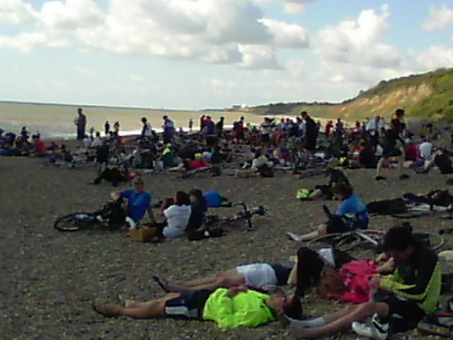
Apart from a very brief period just before dawn I hadn’t felt tired during the ride, which was great as I have bad memories of getting sleepy and having hallucinations on some night rides. Starting in the evening made it easier, much better than finishing at everybody else’s breakfast time after some 24 hours riding, or trying to ride two nights without sleep (I won’t try that again). And of course it was a short night, the Northern sky went very deep blue, but never really got dark. The full moon illuminated the ride for most of the night, although it clouded over for a while before dawn. At Dunwich there was the amazing sight of hundreds of cyclists on the beach;Cyclists on Dunwich beach many of them asleep, but quite a few brave souls were having a swim in the dreadfully cold North Sea. (No I didn’t.)

Southwark cyclists had organised coaches to take participants back to London, and accompanying lorries stacked full of their bikes. I had pre-booked a ride and caught the 11 am bus back to the smoke. There was much that could have gone wrong with these arrangements, especially given the number of participants, but thanks to meticulous organisation that was never officious or unnecessary the operation was very smooth. As an exercise in logistics I’d say it was a triumph. Southwark Cyclists could run London so much better than the Mayor! The only thing that let down the organisation was a nasty scuff on my handlebars due to some very clumsy packing in the lorry that must have left my handlebar rubbing against something metallic.

Overall the ride was better than I expected by some margin. I’d expected to be sleepy but wasn’t. I took it easy all the way round so there was no physical strain either. No rain and a favourable wind helped a lot of course, and apart from twisting my handlebars and shaking loose the back mudguard there were no mechanical issues either, so luck was on my side. Above all though it was a great pleasure to share the ride with so many other cycling enthusiasts; the spirit of the ride was not (in general) trying to ride as fast as possible, it was very much a fun run. I’d heard so much about this ride I felt I should do it once, but having enjoyed it so much it won’t be a difficult decision to do it again.

Happy Birthday LHT

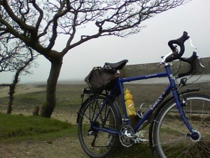
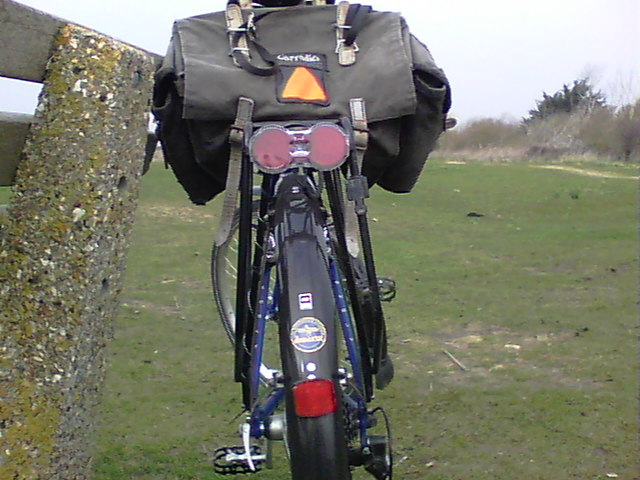
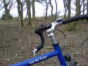
I’ve had my beautiful blue Surly Long Haul Trucker for a year now,Surly LHT so it seems a good time to record my impressions now that the initial romance has worn off.  I can still remember my first impression on a test run of the bike: “Wow this is the most comfortable bike I’ve ridden!”, and 3700 km later that is still a striking feature. In fact having changed the horrible original saddle for my old Brooks B66 the bike now feels like a favourite leather armchair; it really is a wonderfully comfortable bike that you can ride all day with no aches and pains. The LHT flows so easily you don’t need to think about it, just enjoy the views and the ride. This adherence to Newton’s First Law of Motion is reinforced by the totally neutral handling, the bike feels neither quick nor slow, the best short description of the handling is ‘non-intrusive’ because you never really notice the handling characteristics.

Most of my rides on the LHT have been longish day rides for fun, and the bike has been great in this role. However part of my reason for buying the LHT was its capability for multi-day tours. I didn’t get my touring act together in 2011 so can’t report on how it works in this role, but maybe this year I’ll be able to get away for a few days on the bike.
A misty morning in March

What isn’t so good? Well the LHT isn’t a fast bike; it has a strange character in that it will roll along very happily at the speeds it likes to go, in my case this is around 24 kph in neutral conditions. At these speeds the bike becomes transparent (in the sense that you don’t notice the need to input the power). But try to maintain faster speeds and it becomes reluctant; you can always feel its need for the extra input, and sooner rather than later you relax back into the speed it wants to go. The exception is going downhill; the LHT descends brilliantly thanks to the long wheelbase, the low bottom bracket and neutral handling, it remains firmly planted on the road and carves through bends really nicely, making it a really fast, confidence-inspiring downhill machine. However what goes down must come up, and for my taste the LHT isn’t the most pleasant climber; the bike doesn’t respond well to being pushed … you can stick the bike in one of its very low gears and grind your way uphill but it’s really slow doing it this way, and if you try dancing on the pedals in a higher gear the bike reminds you of its weight and you soon revert to the low gears and take it easy until the hill is crested.

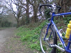
LHT in the woodsNothing has broken during the past year and everything works well now that Brixton Cycles have reconfigured the Tektro Oryx brakes. These cantilever brakes work OK now, but they are not great stoppers and may become a bit marginal if the bike is heavily loaded. Brixton Cycles are a great source of sensible advice and knowledge – and good people to deal with, I can wholeheartedly recommend them with no reservations. I ordered the LHT with a Shimano hub dynamo, but I kept the original front wheel as well to save wear on the dynamo when there was no possibility of cycling in the dark. However I’ve used the original wheel very little as night-riding has been a possibility on so many of my rides, and the lights have often been useful during the daytime in English mists and town traffic.

Hitting the trailThe calm, well-mannered behaviour of the bike makes it equally at home on off-road trails as it is on tarmac; it’s a real “go anywhere” bike unless you want to explore more extreme mountain bike routes. On gravel or hard packed mud it is really secure and seems quite happy to roll gently along, giving the rider plenty of opportunities to enjoy the scenery.

Overall I’m very pleased to have the LHT as part of my limited stable of bicycles. It’s not my first choice for a fast ride, or even to go shopping (although it could fulfil this role really easily), it’s not my most fun bike (that would be my fixed wheel), but for a l_o_n_g day in the saddle in mixed conditions it’s my top bike.

Calibrating GPS altitude

I use a Ventus G730 GPS route logger to record my bike rides. The device reads position and elevation from the GPS satellites; the data is stored internally in a binary format and this data can be extracted and converted to a human-readable XML format such as gpx. I use skytraq-datalogger on a linux computer to do this. The gpx files record position, elevation, time of day and speed throughout a ride, and may be uploaded to a mapping service such as http://bikeroutetoaster.com or http://bikehike.co.uk.

On the whole the positioning data is very good; only once on a ride in North Hampshire was I magically moved to a trackpoint in mid-Wales before returning immediately to the correct route. The error certainly made a huge difference to the distance covered on that ride! I put the problem down to a satellite wobble, or a blast of cosmic rays, but it could equally have been some local corruption on the GPS device, or my computer.

Elevation data is a different story. I want to record how much I climb and descend on my bike rides, but the elevation data seems much more unreliable than the positional data both in terms of the accuracy of the height according to the satellites, and in the frequency of transient errors.

start point
On a recent shopping trip I diverted to the 100m contour line at SU660065 (50.854N, 1.063W according to the Ordnance Survey), located on the ridge of Portsdown Hill overlooking the city  of Portsmouth.

I cycled down the North side of the hill to the 40m contour line at SU665080 (OS say this is at 50.868N, 1.055W), which is by a corner in Purbrook Heath,
turning point
then I cycled back to the starting point.
End point (same as start point)
The GPS logger was switched on at the start where I left it for a little while to be sure it acquired a good signal, the time of day according to my watch was recorded. At the turning point I remembered to reset the trip odometer on my bicycle computer, and again recorded time of day before climbing back up the hill where I parked in the same place, noted time and distance, then switched off.

The results shown below are a mixture of good and bad … all the GPS values are taken directly from the gpx file derived from the satellite data. Times are rounded to the nearest minute (my watch wasn’t synchronised to GMT), latitude and longitude are rounded to 3 decimal places, altitude is rounded to the nearest metre. As contour lines are not marked on the road all the readings were taken at positions limited by my ability to read the 1:50000 map sufficiently accurately. If we accept the GPS locations as fairly accurate then the start, mid and finish positions do look sufficiently close to the contour lines for us to be able to assume the actual heights are as given on the OS map:

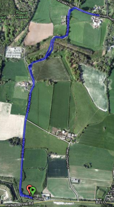
hybrid view of route

Route shown by bikeroutetoaster

Start time (watch): 14h45
Start time (GPS): 14h45
Start location (OS): 50.854N, 1.063W
Start location (GPS): 50.854N 1.064W
Start elevation (OS): 100m
Start elevation (GPS): 142m

Mid time (watch): 14h57
Mid time (GPS): 14h55
Mid location (OS): 50.868N, 1.055W
Mid location (GPS): 50.868N, 1.056W
Mid elevation (OS): 40m
Mid elevation (GPS): 85m

Finish time (watch): 15h13
Finish time (GPS): 15h13
Finish location (OS): 50.854N, 1.063W
Finish location (GPS): 50.854N 1.064W
Finish elevation (OS): 100m
Finish elevation (GPS): 144m

There is clearly a problem with the GPS elevation data in the gpx file which seems to be around 44m higher than it should be. The only good news is that the error appears to be fairly consistent.

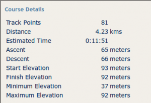
statistics according to bikeroutetoaster

Bikeroutetoaster statistics

Distance mid-point to finish by bicycle computer  was 2.28km, the GPS distance was obtained by uploading the gpx file to the two mapping services given above, both of which showed a total journey of 4.23km, suggesting that each half was about 2.12km.

Note that the elevation figures in the bikeroutetoaster statistics for the ride do not correspond with the numbers in the gpx file.

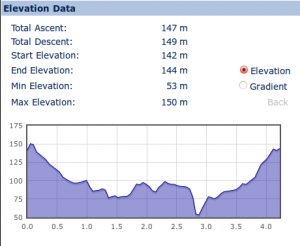
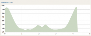
bikehike statistics and profile

bikehike statistics and profile

The bikehike figures on the other hand do correspond with the data in the uploaded file.

Given that the ride was out and back, we might expect to see a symmetrical profile for the ride, reflected around the 2.12km mark, however the asymmetry of the bikehike profile suggests there is a glitch in the elevation data in the gpx file.

route profile by bikeroutetoaster

bikeroutetoaster profile

The bikeroutetoaster profile is more symmetrical and the chasm shown at around 2.75km in the bikehike profile is absent in the bikeroutetoaster version.

The author wrote a very simple program that extracts the elevation data from the gpx file then for each trackpoint it determines if the change in height is up or down and adds the change to total ascent and descent accordingly.  Significantly this program makes no attempt to filter out any erroneous data, it trusts that the given data is accurate. The results obtained when this program processed the gpx file are:

81  lines processed
Total ascent =  153 Total descent=  151
Max height =  150 Min height =  53
Initial height =  142 Final height =  144

The statistics from the home-brew program are tolerably close to the bikehike statistics, but both of these are some distance from the bikeroutetoaster figures.  Inspection of the gpx file directly shows that at 50.864N, 1.062W at 14h52 the height is 78m, while at the same position at 15h04 the height is 53m. As I didn’t notice an earthquake we can conclude that at least one of these values is incorrect, and in fact the second (later) one seems erroneously low compared with the data on either side of it.  There has clearly been some transient effect that has upset the recording of elevation in the original GPS data.  Such errors clearly have a disastrous effect on any attempt to accumulate total ascent; in this case there is a phantom chasm, some 25m deep, to descend and climb.

The mystery remaining is why the bikeroutetoaster elevations, and totals for ascent and descent differ so markedly.  Obviously it does not use the elevation data in the uploaded file. Google maps provide a service that relates position (latitude – longitude) to elevation anywhere on the Earth (including depth locations on the ocean floor) and it seems likely that bikeroutetoaster uses such a third party service to obtain elevation data which is more reliable than the data captured by GPS devices which often seems to be disrupted by variations due to entering buildings, etc.

So if my ride went from the 100m contour to the 40m contour and back, why does bikeroutetoaster show an ascent of 65m and descent of 66m? Well I have to admit that there was a slight defect in the experimental design because the 100m contour that I identified on the map was on the “wrong” side of a small rise. In fact the high point of the ride was on the first (and last) bend shown on the map above, about 20m from the start (and finish) point; so as well as the 60m between the contours I had this extra little lump to climb … twice, also there were some undulations on the way to Purbrook Heath adding to the total climb. So while bikeroutetoaster certainly gets top marks I can’t help but feel its numbers are little bit on the low side.

What I need is a hill that is several kilometres long and is all down (or up) with identifiable contour lines somewhere near the top and bottom.  If you know of anything suitable please tell me in the comments to this post, or do the experiment yourself and let me know!

Conclusions

Altitude data derived from GPS is more unreliable than GPS positional data, this unreliability has been observed over many rides and is confirmed (but not explained) here. Such elevation errors seem to afflict the GPS devices of friends as well, so it seems unlikely that the fault lies in the Ventus G730 alone.

Altitude data is unreliable as an absolute measure, in this case the elevations were over 40m too high when compared with the known heights of the OS contour lines. Readings are also unreliable relative to one another due to transient effects such as shading by trees or buildings; on other occasions we have seen elevation going up and down while we have been sitting in a cafe enjoying a coffee.  In today’s experiment there appears to have been a significant elevation recording error on the return half of the journey, possibly due to riding under trees.

For software attempting to calculate total ascent and descent, consistently high or low values are not a problem, but when errors cause the readings to fluctuate then the software will be recording the  climbing and descending of many virtual mountains and chasms that do not exist in reality.

The bikehike software has an interface that is very easy to use, and includes some excellent features, particularly the way it makes it easy to relate the height on the profile to the position on the map; however the elevation data itself which comes directly from the file uploaded to the website is not to be trusted.  Or putting it another way, the bikehike website is much too trusting of the accuracy of the data provided.  It might be possible to devise some filters to help eliminate some of the errors, for example height should not be changing if latitude and longitude are unchanged (unless you are in a balloon, or a submarine); and it should be possible to set limits for maximum rates of ascent and descent when cycling, and eliminate any elevation changes that go outside these limits. Cleaning up the input file in this way should make measurement of total ascent more credible.

The bikeoutetoaster software adopts the radically different method of using a third party service to obtain elevation data that corresponds to the geographical position obtained from the file uploaded, thus the captured GPS elevation data is ignored. On the basis of several dozen rides uploaded to the website this does appear to give more reliable results.

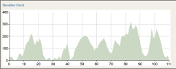
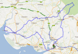
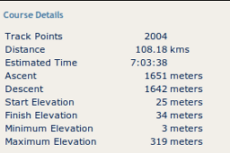
Whether bikeroutetoaster is good enough to meet the standards required to validate AAA (Audax Altitude Award) points is open to question. The author completed the Crwydrad Y Cestyll hilly audax in September 2011, which promised 2200m of climbing in the 111 km ride.

However bikeroutetoaster showed a total ascent of only 1651m. Given that AAA points are based on Ordnance Survey data, and are carefully checked, it seems likely that bikeroutetoaster is missing some elements of the climbs.  So if we are looking for an automated way to obtain AAA values this software falls short.

“Garbage in garbage out” is an aphorism almost as old as the history of computers. We should all be very suspicious of the elevation values obtained from GPS satellites, and related statistics such as total ascent, or gradient of a hill.  On the evidence so far such data would require considerable cleaning up before it might be suitable to give us a satisfactory estimate of total climbing during a ride. The google maps database of elevations, if it is accurate, seems a more reliable source of heights if only because it is not susceptible to strange fluctuations that can cause an elevation profile to look like a seismograph during an earthquake, with knock-on effects for measuring total ascent. However it seems there is still a software challenge for somebody to create a program that will process elevation data that is not garbage in order to produce a satisfactory total of ascent and descent.

UK Health “reforms”

The story in today’s Observer about opposition to the UK government’s health “reforms” by the cross-party Commons health select committee, in addition to concerns from societies for health professionals is made real for me by a compelling story from an end user of the health system in the USA.

Why is the USA experience relevant for UK citizens? Because it’s the source of so many ideas for our right wing.

Meg Hourihan writes very clearly, and movingly, about her experience of insurance based healthcare in the USA. She describes the misery of choosing health insurance for her family, and the appalling annual cost; but even worse her experience of trying to use the insurance to make claims on behalf of herself and her children. Her story is a must-read for anybody in the UK with doubts about the effectiveness or efficiency of our National Health Service, and I won’t spoil her story by trying to summarise it here.

At the risk of sounding like Granpa Simpson the discussion reminds me of an argument I had in 1967 with somebody who was convinced that the NHS was hopelessly inefficient, that the whole business would be much better left to private enterprise, where individuals could choose to purchase insurance that would cover them in case of ill health. Choice would raise the standard of care, and competiton would keep down the costs. Then, and now, the basis for these claims was entirely ideological.

A fundamental problem for the Tories in the 1960s (and now?) was that the NHS was introduced in 1948 by a Labour government and was a manifestation of socialism that needed to be purged, regardless of how successful it might be. It just woudn’t do to have any signs of success deriving from Labour Party initiatives. We saw the same phenomenon in the 1950s … in 1951 the Labour government celebrated the centenary of the 1851 Festival of Britain with a new Festival that created many interesting, well designed buildings, and sculpture, on the South Bank of the Thames. The 1951 Festival was a great success much enjoyed and valued by the people, despite a background of Tory complaints about the cost of the initiative. When Churchill was re-elected Prime Minister in October 1951 one of his first actions was to raze to the ground as much of the site as possible (a few relics remain like the Royal Festival Hall that is now recognised as an architectural asset; a recent exhibition in the RFH commemorating the 1951 Festival gave a good overview of what was lost).

We see the same thing today where good ideas introduced by the previous Labour government have been terminated, usually on the grounds of cost, but actually because no Labour ideas should be allowed to flourish under the new regime. Of course some of these ideas have been reintroduced, rebadged as Tory ideas so that if successful they can claim the credit.

The recent scandal about cheap commercial grade silicone being used in cosmetic surgery gives us another insight into the modus operandi of private healthcare. It seems that at least some high-priced private clinics are little more than management front-ends sub-contracting the actual medical operations to whoever they choose according to their own criteria. What is the benefit for the end-user in such a multi-layered system?

It isn’t clear if the UK government is seeking to wreck the NHS as a matter of covert policy, so that a new US style model can emerge from the wreckage, or if they are destroying the health service by incompetence. But whichever it is the results will be the same, and apart from those who can afford first division insurance, the UK population will pay for this ideological “reform” with poorer health and a shorter life.